जलक्रांती भूजल सर्वेक्षण केंद्र
Jalkranti Groundwater Survey Center
9049107777, 9049205555
shindeajinath7777@gmail.com
Scientific Methods for Accurate Groundwater Detection
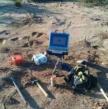
Identify the most potential sites for borewell drilling using scientific resistivity methods and field investigation. A groundwater survey is a scientific process to locate and assess underground water sources, determine their depth and quality, and ensure sustainable management.
It typically involves geophysical methods like electrical resistivity surveys, hydrogeological studies to analyze subsurface geology, and can include test drilling and pumping tests to evaluate potential yield. These surveys are crucial before drilling wells to find the best location, avoid dry or low-yield wells, and prevent over-extraction.
Assess current water use patterns, infrastructure, and potential sources of loss or waste within a system or community.
Define specific, measurable targets for reducing water consumption and improving efficiency.
Implement a combination of technical, educational, and regulatory measures for optimal results.
Ensures a reliable supply of water for future generations and protects the environment.
Lowers water and energy utility bills for individuals, businesses, and municipalities.
Delays the need for new, expensive water source development and capital projects.
Improves a community's resilience to drought and other water-related emergencies.